Satellite Imagery Meets Machine Learning to Chart the Ocean's Hidden Highways
Ocean currents function as a planetary circulatory system, distributing heat and nutrients while influencing global climate. A new method from researchers at UC San Diego's Scripps Institution of...
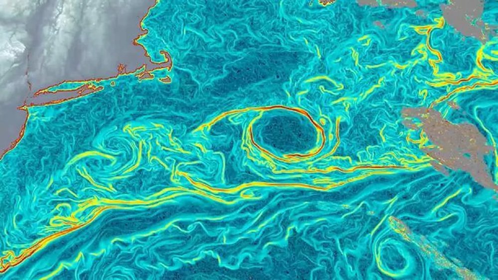
Ocean currents function as a planetary circulatory system, distributing heat and nutrients while influencing global climate. A new method from researchers at UC San Diego's Scripps Institution of Oceanography is providing an unprecedented view of this dynamic system. Their work, published in Nature Geoscience, applies a machine learning model to thermal satellite data, mapping surface currents with remarkable precision.
The project, named GOFlow, originated when oceanographer Luc Lenain observed subtle thermal patterns in satellite images of major currents like the Gulf Stream. He led a team to train a neural network on simulated currents, then applied it to real-world satellite imagery. The model analyzes sequences of images, tracking shifts in sea surface temperature to infer the movement of the water below.
To validate their approach, the team compared GOFlow's outputs against direct measurements from ships and other satellite-based techniques in the Gulf Stream region. The results aligned, but GOFlow delivered a finer-grained picture of current behavior, capturing details previously seen only in theoretical models.
Lenain emphasizes that this is not physics being replaced, but revealed. "The AI helps us extract physical information already present in the observations," he noted, "information that has been difficult to recover with traditional methods." The team is making its code publicly available to encourage broader use and development.
While cloud cover remains a limitation, the project signals a shift in Earth observation. Agencies like NASA and the European Space Agency are increasingly integrating machine learning to analyze vast remote-sensing datasets more efficiently. For industries from agriculture to logistics, understanding the ocean's movements is not just academic—it's a practical necessity for planning and risk assessment.
Source: CNET
Ready to Modernize Your Business?
Get your AI automation roadmap in minutes, not months.
Analyze Your Workflows →